Moor Lane Lake Refurbishment 1992
Location
The fishery is located off Tolpits Lane Watford, next to Watford Piscators, Tolpits Lake.
The boundaries are the Metropolitan Railway to the North East, Tolpits Lake to the North West and a privately owned meadow to the South.
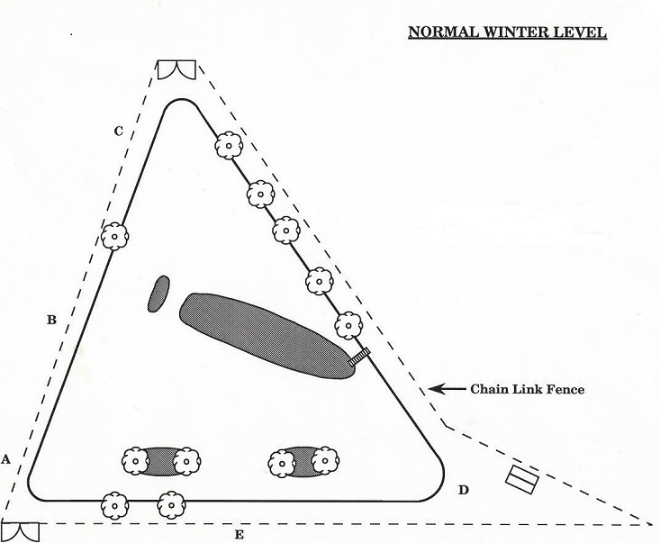
A diagram of the layout of the lake with normal winter water levels is shown at figure 1.
Figure 2
History
The lake was originally dug to provide banking for the Railway.
It was purchased from the Railway Estates in 1976 and has gradually been developed by the efforts of Club members ever since.
In the early days consultations were held with both the Forestry Commission and the Thames Water Authority as to possible development of the site.
For the last few years problems have been experienced with dropping water levels and weed growth, which reduced the number of usable swims to about eight.
In the season 1990/91 after very thorough investigation of weed control it was decided to treat the water with Clarosan.
The treatment was successful and weed growth almost eliminated.
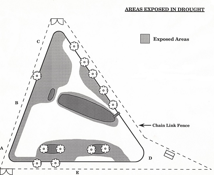
Unfortunately continued dry seasons meant that the water table of the Colne Valley dropped by nearly 800mm and the lake bed was exposed in a number of areas.
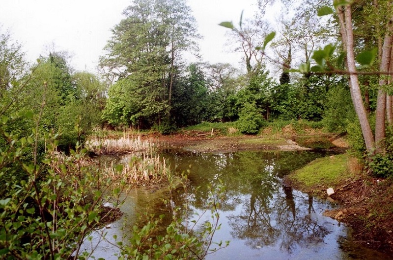
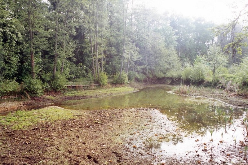
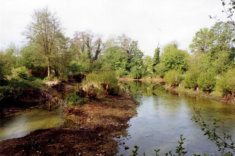
The areas thus exposed are shown at figure 2. Photographs of the lake taken before excavation work was started are also included.
Figure 2
Before Excavation from Point A (Near the Main Gate)
Before Excavation from Point B (Halfway down Tolpits Bank)
Before Excavation from Point C (Near the Canal Entrance)
Before Excavation from Point D (Near the Club Hut)
Action
The Water Management and Club Committees decided that if the club was to have a reasonable fishery then action was needed.
Before the end of the 1991/92 fishing season the Chairman of the Water Management Committee undertook to examine ways of improving the fishery, and various contractors with differing types of equipment were contacted.
Quotations were obtained after visits to the fishery by a number of surveyors and estimators.
The suggestions put forward included sludge pumping, JCBs, bulldozing the bottom after pumping dry, using caterpillar excavators or draglines.
Sludge Pumping: This method was ruled out because land on which to build holding and settling lagoons was needed and there were no suitable sites owned by the club.
Pumping Dry: Although the lake was already separated into two sections by the low water levels, it was felt that this method would be traumatic to existing stock, and that it would be difficult to keep ahead of water rising off the water table.
In addition it would have meant that fish in the unexcavated area would have to be netted and transferred for the final section to be dug.
The contractor who proposed this method did not, in our opinion, realise the problems to be faced.
Drag Line: After further discussions with the agent and the dragline driver this method was selected by the Committee.
Agreement was reached with the owner of the adjacent land to place the spoil in an area where our properties adjoined.
This area was as much as three metres below the level of the surrounding land, and therefore meant that an existing surface water ditch from the railway had to be maintained.
The solution to this was to lay a 75m length of soil drain plastic pipe along the line of the original ditch.
Excavation
The Contractor moved his equipment, consisting of a dragline, caterpillar tractor and trailer (capable of a 12 tonne load), a bulldozer and high volume pump onto the site.
Entry was over the meadow and onto the bank at Point E.
From this point the exposed bed towards the gate was removed and used to fill the channel to get the dragline onto the small island.
The idea was then to build a causeway across to the main island to enable the smaller pool to the North to be dug out.
Difficulties arose at this point because nearly all the material thus far had proved to be black silt.
To obtain suitable gravel in a quantity sufficient to build a causeway to the main island, the area in front of the shed had to be pumped dry and the bulldozer used to compress the water from the gravel.
The original pump was not sufficient for this and another pump, this time of 5" bore had to be used.
When the water level had dropped, gravel was dug to a depth of four metres.
This was allowed to dry over a weekend, and then, with the aid of rafts on the surface to spread the load, the dragline was able to reach the main island.
At this point the lake was divided into three areas of water, one between and the causeway and bridge, the smaller pool to the North of the island and the remaining area which had been excavated first now held all the fish stock.
The small pool was now excavated to a depth of 1.5m all round, and then the barrier to the large pool was removed.
The North side of the island was removed to reduce the island size, and then the dragline returned across the causeway, digging out under the bridge and removing the causeway as it went.
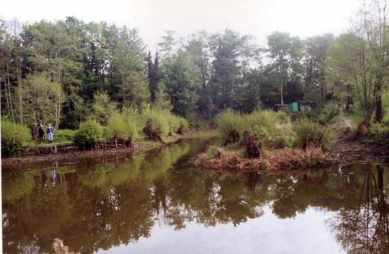
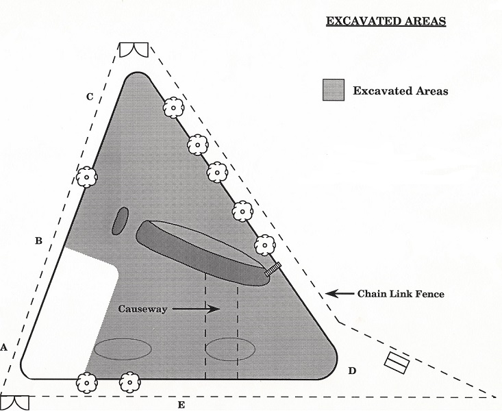
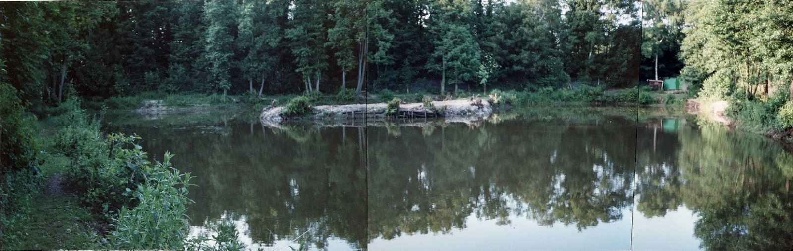
A diagram showing the excavated areas and approximate location of the causeway etc is shown at figure 3.
A panoramic montage of the excavated lake is also included.
Figure 3
Images of the Excavation (Click on Image to see more!)
After Excavation from Point A (Near the Main Gate)
Results
The fishery now has an average depth of 1.5 and 2m at low water levels (2.5 to 3m at normal levels).
During the whole operation due to the co-operation of the contractor and the planning of the sequence of operations, only one fish of reasonable size was lost.
The fishery now has the potential for 25-30 swims and since the season opened has fished well.
Stocking has been considered, but a decision on this will be left until the Autumn and will depend on results during the summer months.
Conclusion
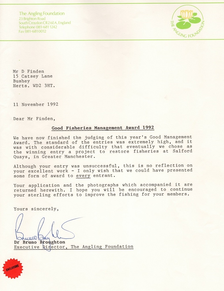
(Ed) The above is an amalgamation of an original document from 1992 with separate images that I was able to restructure into hopefully a flowing web page! Below is a letter that shows that after all the hard work by the contractors and club members we had been nominated for the Good Fisheries Management Award 1992, sadly we didn't win!